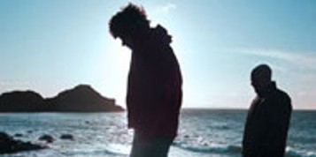
The Dingle Way Waymarked Trail
Dingle - the name rings a bell and the area is a popular holiday destination.The Dingle Way makes a complete circuit around the mountainous Dingle Peninsula from Tralee...
 Dingle - the name rings a bell and the area is a popular holiday destination. The Dingle Way makes a complete circuit around the mountainous Dingle Peninsula from Tralee. The route is mostly along fairly easy paths, tracks and minor roads, but there is one high-level stretch crossing a gap on the shoulder of Brandon Mountain. Accommodation is widely available, but there are some places where the choice is quite limited.
Suggested Walking Schedule
Day 1 Tralee - Camp Miles: 15
Day 2 Camp - Annascual Miles: 16
Day 3 Annuscaul - Dingle Miles: 13
Day 4 Dingle - Dunquin Miles: 13
Day 5 Dunquin - Baile na nGall Miles: 13
Day 6 Baile na nGall - Cloghane Miles: 13
Day 7 Castlegregory - Tralee Miles: 13
Day 8 Castlegregory - Tralee Miles: 13
Day 1
Tralee is the county town of Kerry, and a place of history and culture. Find time to explore the museum and other exhibits in the Ashe Memorial Hall. The Dingle Way leaves town and follows an old ship canal towards a fine arched bridge at Blennerville. There is a windmill and visitor centre at Blennerville, with exhibits focusing on emigration from the area. The route follows a road uphill, then traces a path along the lower slopes of the Slieve Mish Mountains. The ruined village of Killelton is passed and a short detour brings the village of Camp within reach.
Day 2
Leaving Camp, a minor road is followed uphill across the slopes of Corrin. There is a long and gradual descent through a broad and boggy valley, with one section under forest cover. The route runs above the lovely village of Inch, with its famous sandy strand stretching into Dingle Bay. Old roads and tracks lead uphill and across the gap of Maum. To the right is a prominent standing stone and a fine view towards Beenoskee.The little village of Annascaul lies at the end of the road and offers a good range of services.
Day 3
Roads are followed from Annascaul to Kilmurry Bay where Minard Castle stands above an exceptionally bouldery beach. Roads and tracks zigzag inland to the village of Lispole, then the Dingle Way heads towards the lower slopes of the mountains. After passing a series of small farms huddled against the mountains, the route uses the former line of the, famous Connor Pass to reach the busy town of Dingle. A full range of facilities, music, dance and distractions galore are available. Dolphin mania struck the town after Fungi, "The Dingle Dolphin", took up residence offshore some years ago.
 Day 4
Day 4
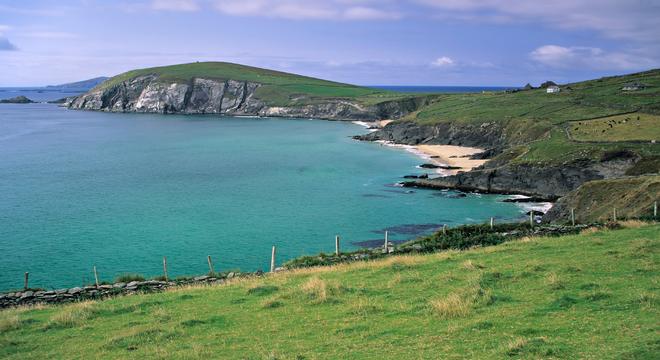
The Dingle Way passes the "Gates of Glory" and other ancient remains on the way to the little village of Ventry. A walk along Ventry Strand is followed by a fine path contouring around the slopes of Eagle Mountain, turning around Slea Head and enjoying fine coastal views. Little stone clochans, or beehive shaped huts, can be seen below the path. After turning Slea Head there is a view of the celebrated Blasket Islands, where a day might be spent exploring if the ferries are running. Dunquin makes a fine base in this area and the scattered village has a small range of facilities.
Day 5
Beyond Dunquin an old road passes behind Clogher Head and the cliffs known as the Three Sisters. A walk around the beaches of Smerwick Harbour can include a detour inland to see Gailarus Oratory - an ancient stone church which is very popular with visitors. The Dingle Way forges deep in the heart of the "Gaeltacht" or Irish speaking area, evidenced by the large number of signs in Irish and the transmitter mast of Radio na Gaeltachta near Baile na nGall.
Day 6
The Dingle Way passes behind Ballydavid Head and proceeds along a road to Brandon Creek, where St. Brendan the Navigator is said to have set sail, and may even have discovered America. The route uses the course of the Military Road, now no more than a vague track, to reach a high gap between Masatiompan and Brandon Mountain. Clear weather is most helpful on this arduous crossing, which is followed by a long descent via Arraglen and Sauce Creek to reach the villages of Brandon and Cloghane.
Day 7
A series of short waymarked trails are available around Brandon and Cloghane, but the Dingle Way leaves the area and takes to the beach at Formoyle. There is a long, sandy beach walk around Brandon Bay to the old church and village at Fahamore at the end of the Magharcees Peninsula. The Dingle Way comes ashore, then heads to the beach on the far side of the peninsula. The walk around Tralee Bay to the village of Castlegregory can be rather more pebbly in places.
Day 8
Roads are used to leave Castlegregory and the beach is regained at Aughacasla. The route can be rocky. The Dingle Way heads around Carrigagharoe Point and passes below the village of Camp, before climbing uphill to reach the ruined village of Killelton. The walk along the Dingle Way could be terminated at Kiliciton, or nearby Camp, or steps could be retraced along the foot of the Slieve Mish Mountains to return to Blennerville and Tralee.
Start planning your vacation... Enquire Now
Driving Vacations in Ireland
Visit anywhere in Ireland at your own pace and experience the charm
See Fly Drive Vacations
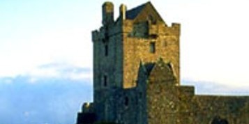
Special Offer $409
7 Day Vacation with stay in an Authentic Irish Castle.
Book Now
Honeymoons in Ireland
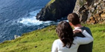
Choose Ireland for your Dream Romantic Honeymoon
See Irish Honeymoons
Escorted Tours of Ireland
All inclusive tours by luxury coach escorted by expert tour guide
See Escorted Tours
Group Tours
Enjoy Ireland with your Group
See Group Vacations