The Slieve Felim Way
The Slieve Felim Way stretches from Murroe in Limerick to Silvermines Village in Co. Tipperary, a distance of about 18 miles...
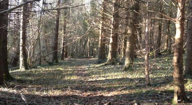

The Slieve Felim Way stretches from Murroe in Limerick to Silvermines Village in Co. Tipperary, a distance of about 18 miles. The walking trail straddles the counties of Limerick and Tipperary. The general area consists of valleys and hills running east west, commencing with the Slieve Felim range to the south and moving northwards to the Mauher Slieve Hills to Keeper Hill and on to the Silvermines Mountains. While avoiding all the peaks, the routes provide scenic views of much of the Region and it is possible to see parts of Counties Clare, Limerick, Offaly,and Tipperary from different locations on the route as well as sections of Lough Derg and also of the River Shannon basin.
 The walk can be divided into three main sections, Murroe to Tooreenbrien Bridge, Tooreenbrien Bridge to Toor and Toor to Silvermines. Beginning at the southerly end, you travel two miles beyond Murroe village to the Thomond Scout Centre where the walk officially begins. You follow the markers along the roads for a distance of approximately two miles, passing on the left-hand side the estate of Glenstal before entering Glenstal Forest. A short distance further on you will find a picnic area and map board specifying the trail. The walk travels through the forest for a distance of 5.5 miles before crossing a small stream coming to the main Newport Thurlas road at Tooreenbridge. At this point the trail turns left and continues along the road for 100 metres before turning right at the gateway and crossing over the Annagh River by way of another foot-bridge.
Shortly afterwards the trail re-enters the forest and proceeds over the Mauher Slieve range before descending into Toor village, a distance of about 4 miles. On rejoining the road in Toor, you turn right and travel for 500 metres until you meet the ball alley and turn left onto the trail again. This section goes up to the easterly side of Keeper Hill and through the Ciamaltha Woods, until it meets the road network at the Old School at Glencullo, a distance of 3 miles. The final section crosses over the Newport river and climbs up to Step Viewing Point passing on the way Knockanroe Wood and another map board detailing the trail. From here, the route descends into Silvermines Village, where the Slieve Felim Way finishes at the carpark.
Start planning your vacation... Enquire Now
Driving Vacations in Ireland

Visit anywhere in Ireland at your own pace and experience the charm
See Fly Drive Vacations
Special Offer $409
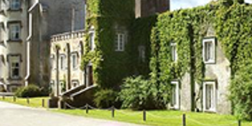
7 Day Vacation with stay in an Authentic Irish Castle.
Book Now
Honeymoons in Ireland
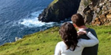
Choose Ireland for your Dream Romantic Honeymoon
See Irish Honeymoons
Escorted Tours of Ireland

All inclusive tours by luxury coach escorted by expert tour guide
See Escorted Tours
Group Tours

Enjoy Ireland with your Group
See Group Vacations